Choosing Between Local Drone Pilots and a National Turnkey Service for Aerial Surveys
@measuredfromabove
When a project calls for aerial imagery or topographic data, the first decision is often whether to hire a local drone pilot or engage a national service that handles everything from flight to data delivery. Both approaches have their place, and the right choice depends on the scale of the project, the level of consistency required, and how the data will be used afterward. Understanding the differences helps you avoid costly rework and ensures you get usable results the first time.
Local pilots offer flexibility and on-the-ground familiarity. They know the local airspace, weather patterns, and site access issues. For a small site or a one-off inspection, a local operator can often respond quickly and provide a personal service. But when the project spans multiple states, requires repeated flights over time, or needs a uniform data format across all sites, the limitations of coordinating several local operators become clear. Each pilot may use different equipment, fly at different altitudes, and process data with different software. The result is a collection of datasets that are hard to compare side by side.
The Case for Local Drone Pilots
Local drone operators are well suited to projects that are geographically contained and do not need to match data from other locations. A single construction site, a small farm, or a local event can be captured efficiently by a pilot who lives nearby. They can visit the site easily, adapt to changing conditions, and often provide a quick turnaround for a single flight. If the data is used only for that one project and does not need to align with other surveys, this approach works well.
Another advantage is the personal relationship. You can meet the pilot, discuss the site in detail, and get a sense of their equipment and experience. For a property owner or small business, this direct contact can be reassuring. The pilot can also advise on the best time of day to fly, local restrictions, and any site-specific hazards that might affect the flight path.
However, the quality and consistency of the output depend heavily on the individual pilot's skill and equipment. Two local pilots operating on different sides of a city may deliver results that look quite different. If you later need to merge those datasets or compare them over time, the differences can become a problem. The more pilots involved, the harder it is to maintain a consistent standard.
When a National Turnkey Service Makes Sense
For organizations that manage multiple sites across different regions, a nationwide turnkey capture service offers a different kind of value. Instead of vetting and managing dozens of local pilots, you work with a single provider that coordinates flights, processes the data, and delivers the results in a standardized format. This approach is especially useful for large-scale surveys, such as pipeline monitoring, solar farm inspections, or agricultural assessments covering thousands of acres.
The key benefit is consistency. A national service uses the same equipment, flight parameters, and processing pipeline for every site. This means the data from one location can be directly compared with data from another, even if they are hundreds of miles apart. For asset managers and engineers who need to make decisions based on accurate, repeatable measurements, this uniformity is critical.
Another advantage is the reduced administrative burden. You do not need to negotiate separate contracts, manage insurance certificates, or chase down individual data deliveries. The turnkey provider handles all of that, often through a single point of contact. For organizations that are already stretched thin, this simplification can free up time and reduce the risk of errors in coordination.
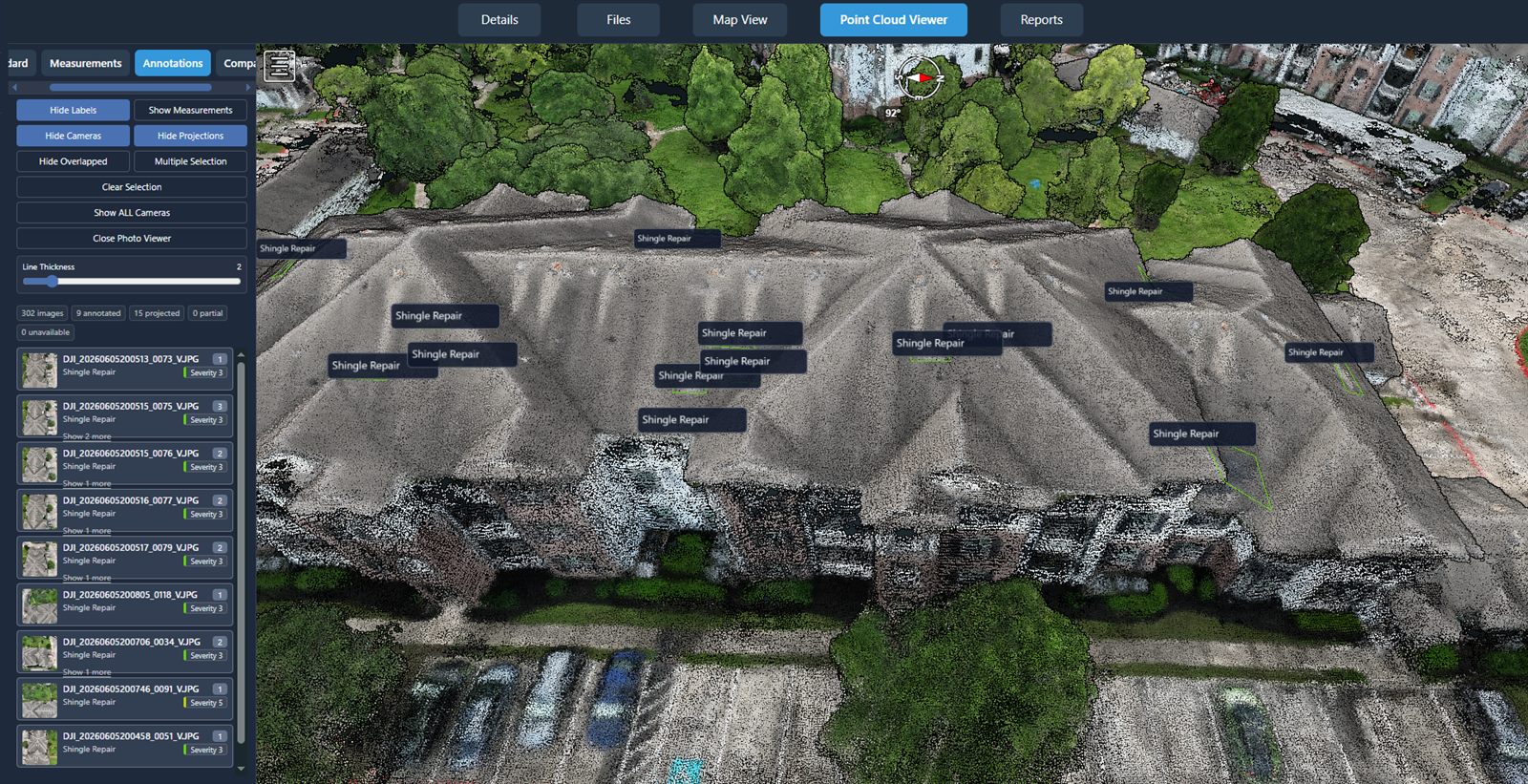
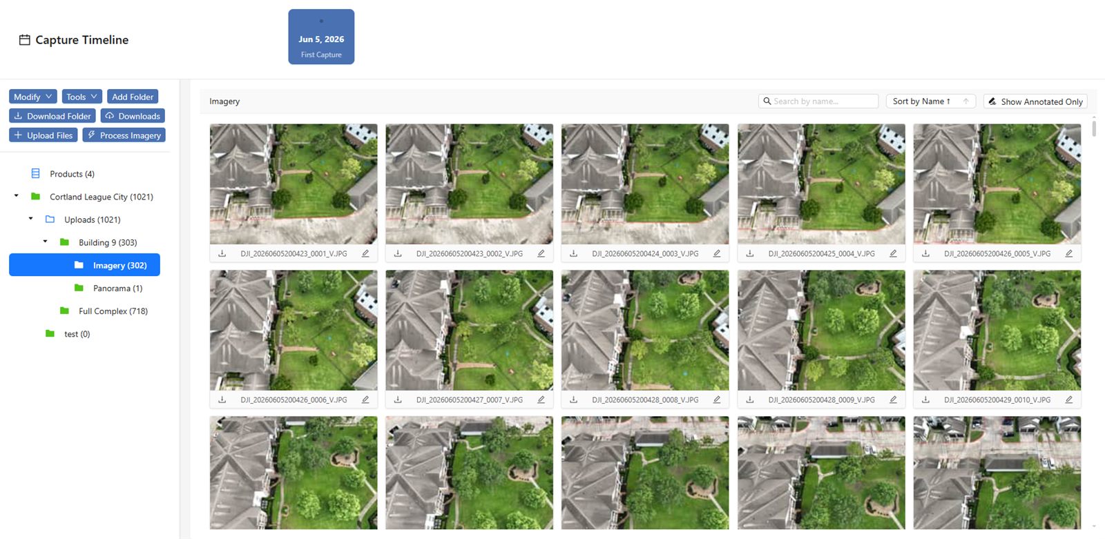
One example of a service that supports this model is the National Drone Services drone data management platform, which provides a central place to upload, process, organize, visualize, compare, measure, and share drone aerial data. When the capture is handled nationwide and the data lands in a platform like this, the entire workflow from flight to analysis becomes more streamlined. The platform itself does not replace the pilot - it complements the turnkey service by giving teams a unified way to work with the results.

Comparing the Two Approaches
The choice often comes down to scale and consistency. Local pilots shine on small, isolated projects where personal service and quick response matter most. National turnkey services excel when you need the same data quality across many sites, or when the data must feed into a larger system for analysis and reporting.
Budget is another factor, though the costs are not always straightforward. A local pilot may appear cheaper on a per-flight basis, but when you factor in the time spent managing multiple operators, reconciling different data formats, and correcting errors, the total cost can climb. A turnkey service charges more per site but often includes data processing and quality assurance in the price. For a multi-site project, the turnkey option can be more predictable and, in many cases, more economical overall.
Timeline also matters. A local pilot can often fly the same week. A national service may need a few days to dispatch a pilot and equipment, but once the system is in place, subsequent flights can be scheduled with similar speed. For recurring surveys - monthly, quarterly, or annually - the national service becomes more efficient because the flight parameters and processing workflows are already established.
What to Look for in Either Option
Whether you choose a local pilot or a national turnkey provider, there are a few things to verify before the job starts:
- Check that the operator holds the required certifications and insurance for the area of operation.
- Ask about the equipment being used: sensor resolution, lens, and any calibration records matter for accuracy.
- Confirm the data format and delivery method. Will you receive raw images, orthomosaics, point clouds, or processed reports?
- For multi-site projects, ask how the provider ensures consistency across flights. Do they use the same flight planning software and altitude?
- Inquire about data management. After the survey, how will you store, share, and analyze the results? A platform like the National Drone Services drone data management platform can simplify that step, but the provider should be able to deliver data in a compatible format.
Making the Decision
Start by defining the goal. If the data is for a one-time use and the site is small, a local pilot is likely the best fit. If the project covers multiple sites, requires repeat flights, or needs data that can be compared across regions, a nationwide turnkey capture service offers the consistency and efficiency that local operators cannot match. The best outcome comes from matching the delivery method to the actual use of the data, not just the lowest upfront price.
Many organizations find that a hybrid approach works: using local pilots for ad hoc needs and a national service for large or recurring projects. The key is to keep the data management layer consistent. When the data from both sources flows into the same system, you retain the flexibility to choose the right capture method for each job without sacrificing the ability to compare results later. National Drone Services and similar platforms make that possible by providing a single source of truth for all aerial data, regardless of where or how it was captured.
National Drone Services on social media
 Facebook